Range Resolution
SSX-1 features a slant range resolution of 1.5 m thanks to its 100 MHz of bandwidth.


SARsatX is building an advanced Earth observation system that combines radar and optical imaging to provide accurate, timely insights for critical decision-making worldwide.
Satellites
SARsatX works on a constellation of 16 satellites that are specially designed to ensure the best level of service for our customers as it is able to provide them with the required data of various types and patterns within four hours only, which we aim to operate at full capacity by 2027.
satellite constellation delivers reliable and timely SAR imagery. A large constellation distributed uniformly enables us simultaneously to reach a high speed of response and to frequently scan large areas at the same time. A large SAR constellation offers an enormous amount of acquisition possibilities to capture the territory of entire nations at high resolution, and more, in a single day. The imagery of SAR satellite constellation is not constrained by weather conditions or the need for sunlight.
Our Products
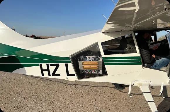
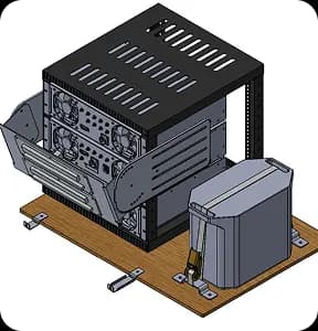
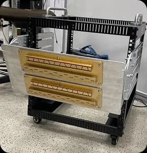
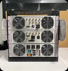
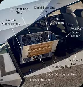
SSX-1 is an advanced airborne SAR payload developed to validate real-world use cases and refine satellite system design through high-quality data collection. By enabling flexible and targeted Earth observation missions, SSX-1 supports the generation of actionable insights across critical applications, helping bridge the gap between raw radar data and informed decision-making.
SSX-1 features a slant range resolution of 1.5 m thanks to its 100 MHz of bandwidth.
The airborne system is fully-polarimetric, enabling advanced detection of target scattering mechanisms.
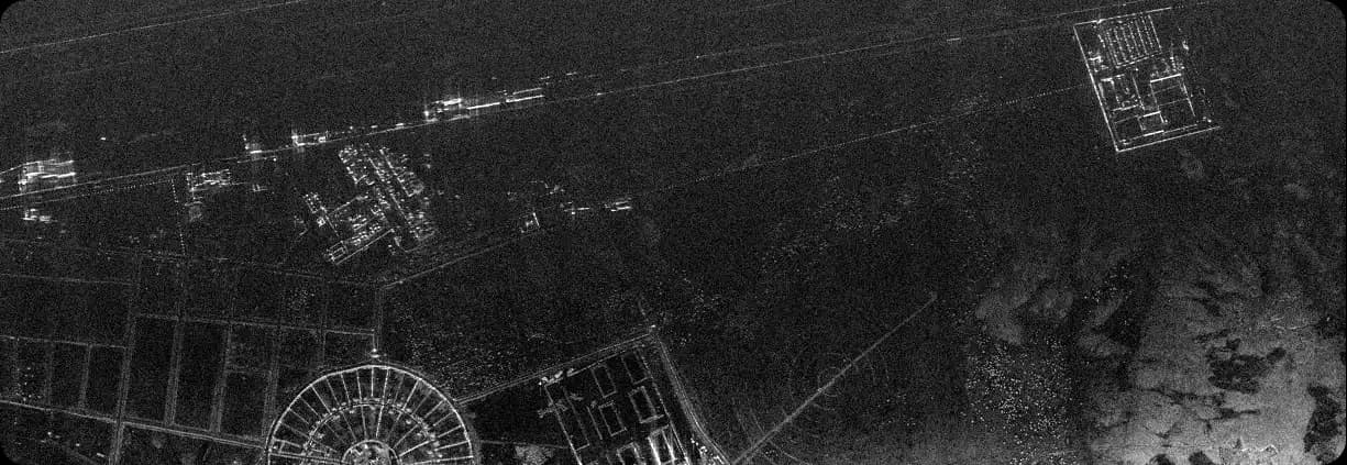
Operation at X-band results in SAR images that resemble optical images for easy interpretation.
At a peak transmit power level of 20 W, the system does not demand complex power supply from the aircraft.
At a peak transmit power level of 20 W, the system does not demand complex power supply from the aircraft.
Sensors
Our unique combination of SAR and optical data guarantees accurate data at all times. Through seamless integration with the EarthLife platform, users receive instant analytics, automatic interpretations, and tools that support confident decision-making.
Works day and night, in dust and clouds, ensuring data availability at all times
Clear, high-resolution images in suitable weather conditions
Automated pipelines for rapid transformation of raw data into actionable insights
Rigorous quality assurance and secure data handling protocols


EarthLife Platform
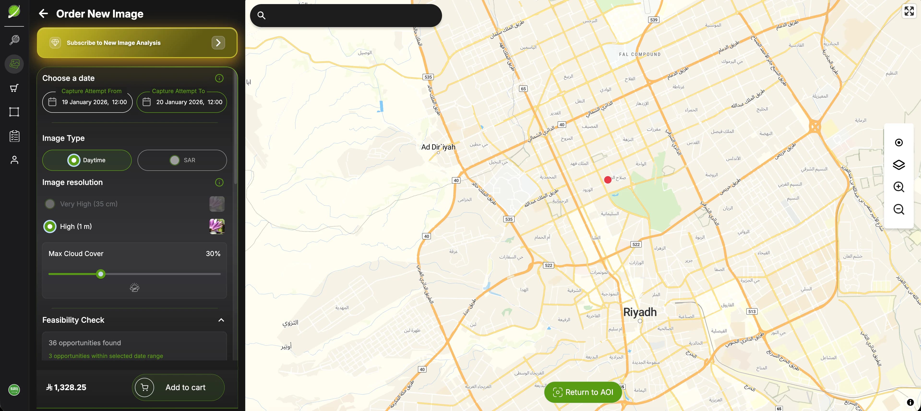
EarthLife puts mission tasking directly in your hands. Our fully automated scheduling system enables users to submit new imaging requests through a seamless, on-demand self-service interface.
EarthLife is where satellite missions turn into decisions. The platform connects tasking, data processing, and intelligence delivery in one continuous flow—allowing users to move from defining an area of interest to understanding what is happening on the ground, without friction, delay, or complexity.
On-Demand Satellite Tasking
AI-Driven Image Analytics
Multi-Source EO Data Integration
Actionable Insights Delivery
EarthLife analyzes satellite imagery using AI to deliver accurate, timely insights for evidence-based decisions across government and enterprise sectors.
Built to meet the operational needs of both public authorities and commercial organizations.
Combines SAR and optical data with AI to unlock deeper understanding and automation.
A unified platform built by SARsatX to analyze and manage satellite imagery efficiently.
Converts complex satellite data into clear insights delivered when decisions matter most.
Enables confident decisions using reliable data and actionable intelligence.


